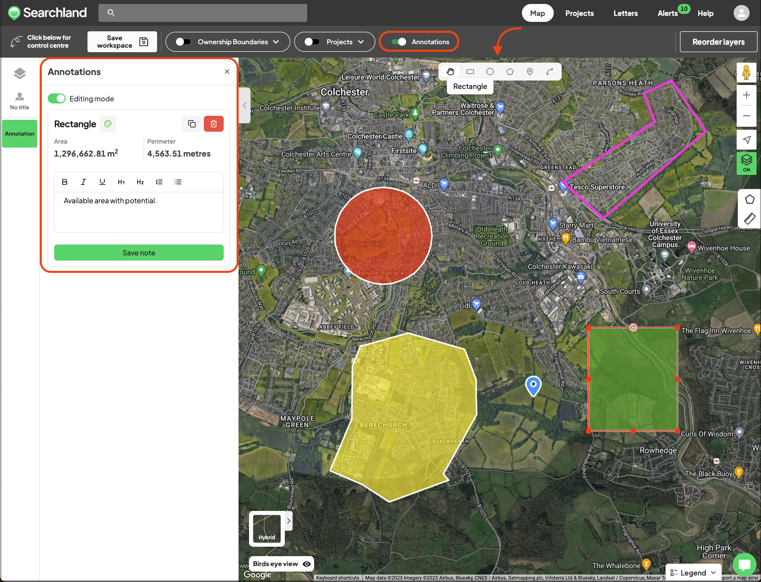
Annotations is a tool that allows you to add notes, draw potential sites, and outline building footprints directly on our digital map. Whether you're planning a project, outlining buildings, or pinpointing key locations, this tool allows you to customise your map without the need to switch between apps.
This tool was designed to streamline your workflow, enabling you to create and modify annotations, and craft site outlines, all within the Searchland platform.
Here’s all that you can do:
Draw an array of shapes, including circles, rectangles or freeform polygons
Change the colour, duplicate, rotate and resize drawings
Add and edit text notes
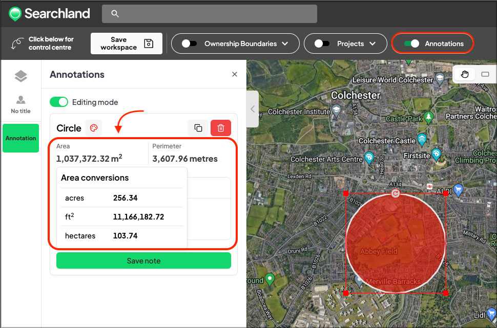
Automatically calculate the area of drawings in m2, ft2, acres and hectares
Share your annotations, notes and drawings with your team
Edit or remove annotations as your plans evolve
Highlight areas of interest with the pinpoint tool
To start drawing, toggle on the 'Annotations' button at the top bar and select the options that come up at the top-centre area of your map. Whenever you wish to hide your annotations, simply toggle off the 'Annotations' button.
💡Top tips:
Your drawings are visible whenever the 'Annotations' button is toggled on and the map is positioned on the area in which you have drawn. If you can't see your drawing, make sure you zoom in on the map.
Notes are always associated with a drawing or a pinpoint. To see a saved note, make sure you click the drawing/pinpoint in which the note was saved to.
To see the area conversions in acres, ft2 and hectares simply hover over the area number in m2.
To change the colours of your drawings/pinpoints, click the paint palette icon on the left side bar.