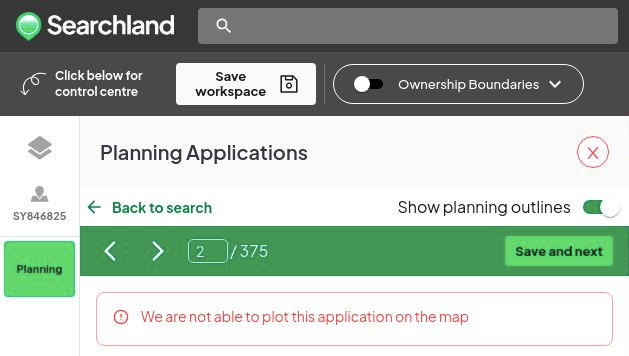
At times, we are unable to geocode every planning application that we collect. When we recognise that accurate geocoding is not possible, the application is not displayed on the map. However, these applications are still accessible through the Planning Applications' search.
Why can't we geocode these applications?
There are several reasons for this:
Lack of a Map: Some planning applications do not include a map indicating their location on the planning portal, making it impossible for us to pinpoint their geographical coordinates accurately.
Exclusion from Existing Maps: In cases where a map is provided, this specific application might not be included on it. This omission prevents us from mapping it accurately.
Missing Coordinates: The application does not provide either easting/northing or longitude/latitude coordinates, which are necessary for precise geocoding.
No UPRN (Unique Property Reference Number): The absence of a UPRN, a unique identifier for properties, complicates the geocoding process.
Vague Address Information: In situations where the address provided is ambiguous or lacks detail, we may not confidently match it with any of the addresses available from authoritative sources such as Ordnance Survey and other reliable references.