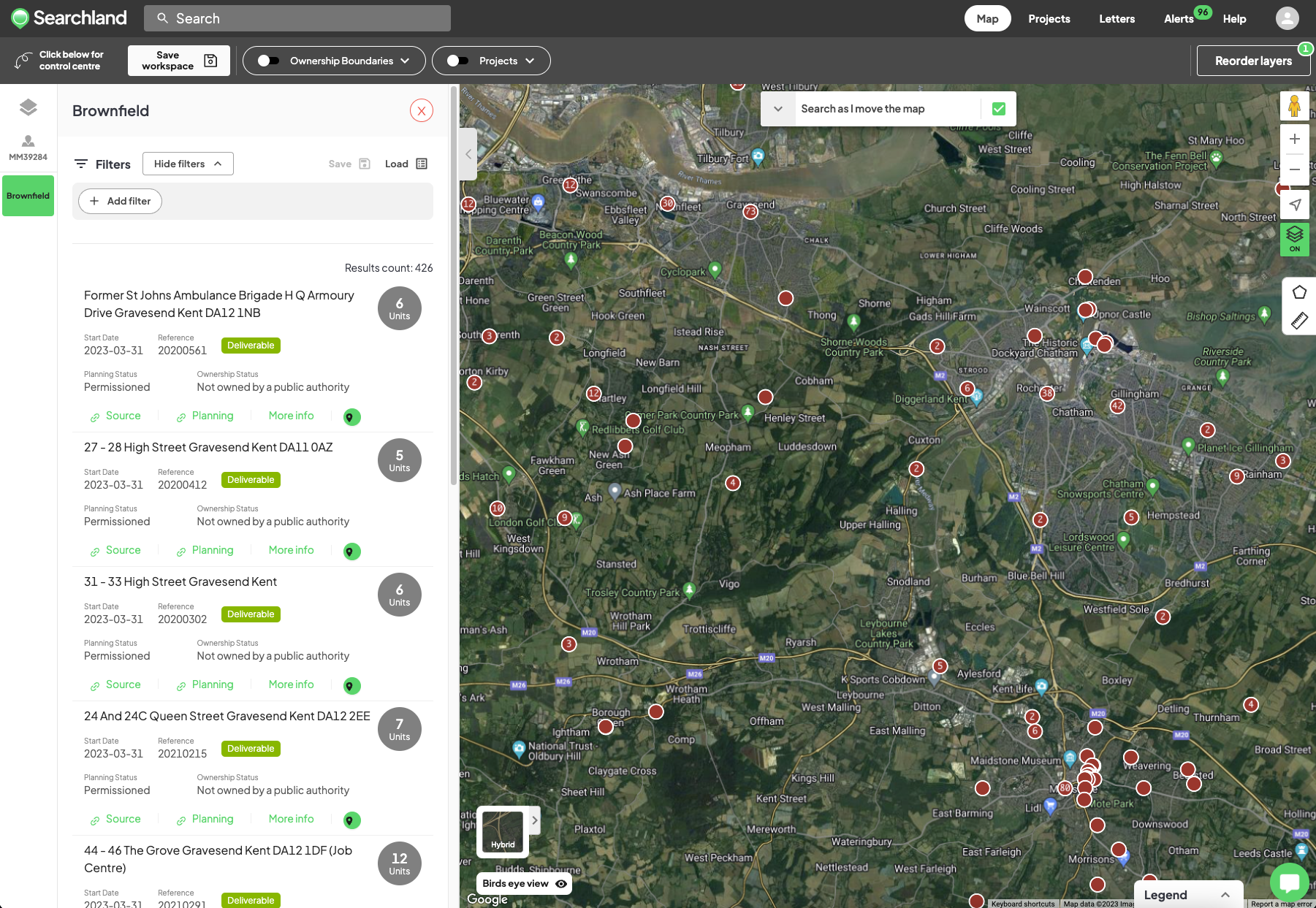
The numbers within the red circles when using the Brownfield tool represent the quantity of brownfield land within a particular area.
As you zoom in on the map, the count of brownfield land within that specific area should mirror the number displayed within the corresponding red circle.